Canaria info forside billede tekst

City tour in Las Palmas with the red topless bus.

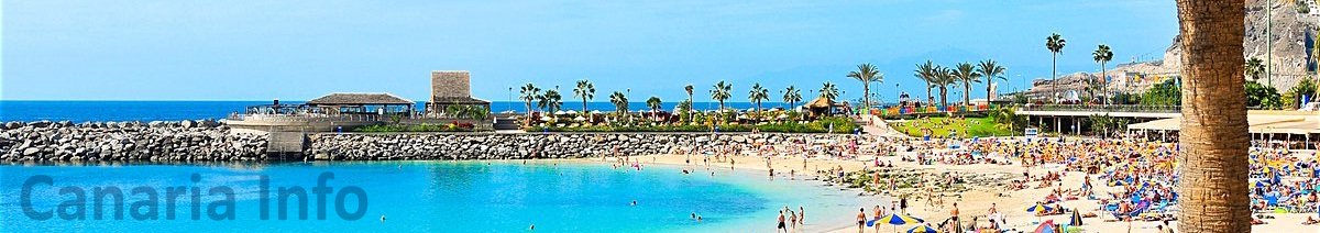
If you want a break from the beach, then Las Palmas is a really good substitute. Las Palmas is a fantastic metropolis that offers many exciting experiences. You may not be able to look for the various attractions, but with Citybus, you will be served the whole city. Citybus allows you to see Las Palmas from 4 meters high and 360 degrees around, and of course you are sitting in the open sky.
It is an on / off bus, so you can get off if you want to take a closer look at an area when the next bus comes by, then just get on again and continue where you left off. A bus comes by every 35 minutes and your ticket is valid for 24 hours. Included in the trip is a set of headphones and guided in 8 languages ​​throughout the tour.
The first trip runs at 9:40 AM and the last rone at 6 PM
There are 3 different types off ticket. I will describe the different options below.

"City Sightseeing" Including the ticket are:

The guide speaks English and Spanish

WI-FI in the bus

Hike in the old town "Vegueta" Meeting point at stop # 5 and the walk takes about 1 hour.
Visit to Auditorio "Alfredo Kraus"
Tapas and drinks at "Casino Las Palmas" (see flyers)
Free parking if you drive part of the ride yourself

This ticket costs 20 Euro for adult and 10 Euro for children (5 - 15 years)

The ticket is valid for 24 hours

”City Sightseeing” Las Palmas shopping – Inklusiv billetten er:

WI-FI I Bussen

Hike in the old town - Vegueta. Meeting point at stop # 5 and the walk takes about 1 hour.
Visit to Auditorio "Alfredo Kraus"
Free admission in the “Nestor” museum
Free entrance to the cathedral tower
3 tapas and 3 drinks at different restaurants
Tapas and drinks at Casino Las Palmas (see flyers)
Discount on purchases in ”El Corte Ingles and C.C. "Las Arenas"
Free parking


This ticket costs: Adult 25 Euro and children 15 Euro (5 - 15 years) The ticket is valid for 24 hours


"City Sightseeing" Las Palmas museums - including the ticket are:

WI-FI I Buses

Hike in the old town - Vegueta
Visit to Auditorio "Alfredo Kraus"
Free admission to the theater "Perez Galdos"
Free admission to the “Nestor” museum
Free entry to the cathedral tower
Free admission to the "Canario" museum
Free admission to the "Eldar" museum

Tapas and drinks at "Casino Las Palmas" (see flyers)
Free parking

This ticket costs: Adult 29 Euro and children 19 Euro (5 - 15 years) The ticket is valid for 48 hours


Tickets can be purchased by ordering at This email address is being protected from spambots. You need JavaScript enabled to view it.  or on our chat, at the bottom of the front page

                       Below you will see the route map. A bus passes every stop every 35 minutes.

No matter which trip you choose, you can sit in the bus and drive around, or hop off if you want to walk around a bit and continue again after the break. You can take as many laps as you want if you didn't get it all at first.

Free Advice - Canariainfo

E-mail:
postmaster@canariainfo.com

Skype name:
canariainfo
Canariainfo Skype
Youtube channel:

Canariainfo - Youtube

We can help you with:

  • Quality hotel stays
  • The best restaurants
  • Reliable car renting
  • Guding you about the island’s attractions
  • Arranging fishingtrips
  • Setting up island trips
  • Biketrips and bikerenting
  • Kamelridning
  • And much much more…
See you in Gran Canaria!
  • Hiking Route 7. Valsequillo - San Roque via Corona del Montañón

    Hiking Route 7. Valsequillo - San Roque via Corona del Montañón

    Hiking Route 7.  Valsequillo - San Roque via Corona del Montañón Starting point:Valsequillo Altitude: 580 mDestination:San Roque Altitude: 330 mTotal Distance: 9140 mTime to cover the Route: 3h. 30’Direction of the Route: SE-NW/W-EMaximum Difference in Altitude: 621 mDifficulty rating: Low This route is renowned for its ethnographic values related to traditional agricultural and livestock uses. In addition, the first section is Read More
  • Hiking Route 2. Caldera de Los Marteles – Las Vegas via Los Cernícalos ravine

    Hiking Route 2. Caldera de Los Marteles – Las Vegas via Los Cernícalos ravine

    Hiking Route 2.  Caldera de Los Marteles – Las Vegas via Los Cernícalos ravine Starting pointLos Marteles Caldera Altitude: 1530 mDestination:Las Vegas Altitude: 620 mTotal distance: 9490 mTime to cover the Route: 4h. 30’Direction of the Route: W-ENet Difference in Altitude: 910 mDifficulty rating: Medium-high The route includes one of the most interesting areas of the Los Marteles Special Nature Reserve. Read More
  • Hiking Route 5. Tenteniguada - Valsequillo

    Hiking Route 5. Tenteniguada - Valsequillo

    Hiking Route 5.  Tenteniguada - Valsequillo Starting point:Tenteniguada Altitude: 801 mDestination:Valsequillo Altitude: 538 mTotal Distance: 3060 mTime to cover the Route: 50-60 minutesDirection of the Route: W-ENet Difference in Altitude: 237 mDifficulty rating: Low This route is of huge cultural and ethnographic importance, as it has historically communicated the two main centres in the municipality. A glance at the cobbles on Read More
  • Hiking Route 1. Los Marteles Caldera - Rincón de Tenteniguada via El Salviar. Blue Tajinaste Routes

    Hiking Route 1. Los Marteles Caldera - Rincón de Tenteniguada via El Salviar. Blue Tajinaste Routes Starting point:Los Marteles Caldera Altitude: 1529 mDestination:Rincón de Tenteniguada Altitude: 1043 mTotal Distance: 3470 mTime to cover the Route: 1h. 30’Direction of the Route: SW-NENet Difference in Altitude: 486 mDifficulty rating: Low   The route begins to the north of the Los Marteles Caldera and Read More
  • Hiking Route 6. Valsequillo - Las Vegas

    Hiking Route 6. Valsequillo - Las Vegas

    Hiking Route 6.  Valsequillo - Las Vegas Starting point:Valsequillo Altitude: 550 m Destination:Las Vegas Altitude: 612 mTotal Distance: 1890 mTime to cover the Route: 50minutesDirection of the Route: NE-SWMaximum Difference in Altitude: 141 mDifficulty rating: Low This is a route that formerly connected two traditional agricultural valleys, crossed by the San Miguel and Los Mocanes ravines. The surface is made up Read More
  • Hiking Route 3. Cuevas Blancas Dam - Rincón de Tenteniguada via La Pasadera ravine. Blue Tajinaste Routes

    Hiking Route 3. Cuevas Blancas Dam - Rincón de Tenteniguada via La Pasadera ravine. Blue Tajinaste Routes

    Hiking Route 3.  Cuevas Blancas Dam - Rincón de Tenteniguada via La Pasadera ravine. Blue Tajinaste Routes Starting point:Cuevas Blancas Dam Altitude: 1665 mDestination:Rincón de Tenteniguada Altitude: 973 mTotal Distance: 3420 mTime to cover the Route: 2hr. 15’Direction of the Route: SW-NENet Difference in Altitude: 692 mDifficulty rating: Medium-low For the most part, this route crosses the Los Marteles Special Nature Read More
  • Hiking Route 9.  Los Marteles Caldera - Tenteniguada via Los Alfaques. Blue Tajinaste Routes

    Hiking Route 9. Los Marteles Caldera - Tenteniguada via Los Alfaques. Blue Tajinaste Routes

    Hiking Route 9. Los Marteles Caldera - Tenteniguada via Los Alfaques. Blue Tajinaste Routes Los Marteles Caldera Altitude: 1529 mDestination:Tenteniguada Altitude: 767 mTotal Distance: 5880 mTime to cover the Route: 2hr. 15’Direction of the route: SW-NENet Difference in Altitude: 762 mDifficulty rating: Low                                           The route runs SW-NE and is classified as a low difficulty itinerary although it can be slippery in the Read More
  • Hiking Route 8.  Rincón de Tenteniguada - Roque la Vela - Rincón de Tenteniguada, Route of the Ravines. Blue Tajinaste Routes

    Hiking Route 8. Rincón de Tenteniguada - Roque la Vela - Rincón de Tenteniguada, Route of the Ravines. Blue Tajinaste Routes

    Hiking Route 8. Rincón de Tenteniguada - Roque la Vela - Rincón de Tenteniguada, Route of the Ravines. Blue Tajinaste Routes Starting point:Rincón de Tenteniguada Altitude: 970 mDestination:Rincón de Tenteniguada Altitude: 970 mTotal Distance: 2750 mTime to cover the Route: 1hr. 15’Direction of the route: NE-SW/W-E/S-NMaximum difference in altitude: 205 mDifficulty rating: Low Most of this circular route leads through the protected areas Read More
  • Hiking Route 10. Tecén - Colmenar Bajo via San Miguel ravine

    Hiking Route 10. Tecén - Colmenar Bajo via San Miguel ravine

    Hiking Route 10. Tecén - Colmenar Bajo via San Miguel ravine Starting point: TecénDestination: Colmenar BajoTotal distance: 4930 mTime to cover the route: 2 h.Direction of the route: E-WNet difference in altitude: 253 mDifficulty rating: Low This route goes all along the San Miguel Ravine and connects to two other routes starting at the town of Valsequillo: route nº6 towards Las Read More
  • Hiking Route 4. Cuevas Blancas Dam - Rincón de Tenteniguada via Roque Jincao. Blue Tajinaste Routes

    Hiking Route 4. Cuevas Blancas Dam - Rincón de Tenteniguada via Roque Jincao. Blue Tajinaste Routes

    Hiking Route 4.  Cuevas Blancas Dam - Rincón de Tenteniguada via Roque Jincao. Blue Tajinaste Routes Starting point:Cuevas Blancas Dam Altitude: 1665 mDestination:Rincón de Tenteniguada Altitude: 971 mTotal Distance: 5150 mTime to cover the Route: 2hr. 30’Direction of the Route: SW-NENet Difference in Altitude: 694 mDifficulty rating: Medium The scenic attractions of this route are determined by the fact that it Read More
  • 1
  • 2
  • 3
  • 4
  • 5
  • 6
  • 7
  • 8
  • 9
  • 10

13 Udspring
Skydiving  -  feel the rush

Forside 1
Europe's largest saltwater aquarium

Supercar forside 1Supercar GC  - Race and fun


Vespando tours  With GPS

Logo 3
Cardenas holiday homes

Engelsk miniature
The Scandinavian dental clinic

10-215x140
Cadido bus and taxi

Sioux City 1
Sioux City - Cowboy country for big and small

Fish on forside 03Sportfishing with "Fish on"

pluscar reservation 215x140
Pluscar, best and cheapest car hire.

Spirit of the sea 215

Spirit of the sea - Dolphin and Whale tour


Fly Gran Canaria 5
Fly Gran Canaria - Puerto Rico

Surtidor Forside
Cold and hot dishes, ready to take with you

Aqualand Maspalomas Forside 1
Waterpark Maspalomas for all ages.

Palmitos Park forside 1Amazing zoo, with dolphins.

Cookies Information
This website uses cookies to ensure you get the best experience on our website.
All Cookies follows applicable laws, privacy policy.